Mapping glaciers with drones in Svalbard – this is how we actually do it
Researchers at UNIS conduct fieldwork on Svalbard glaciers using drone technologies. The goal is to improve our understanding of how climate change accelerates the melting of glaciers. I wrote an article explaining how the drone fieldwork is conducted.
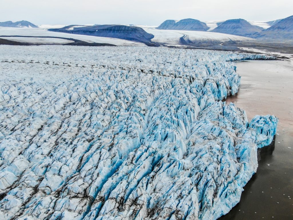
A typical summer fieldwork day starts in the morning with a safety briefing. We discuss the weather forecast and all potential risks that we might encounter during the trip. Then we gear up and drive out to the small boat harbour outside Longyearbyen. We load our gear on the Polarcirkel workboat and start driving towards one of the many glaciers in Svalbard. We are interested in crevassed tidewater glaciers, there is plenty of interesting locations for us. For this trip, we are going to Tunabreen in Tempelfjorden. The boat trip to the glacier lasts more than an hour but is a good opportunity to observe the wildlife. We have seen lots of seabirds, seals, whales, and even polar bears during our trips.
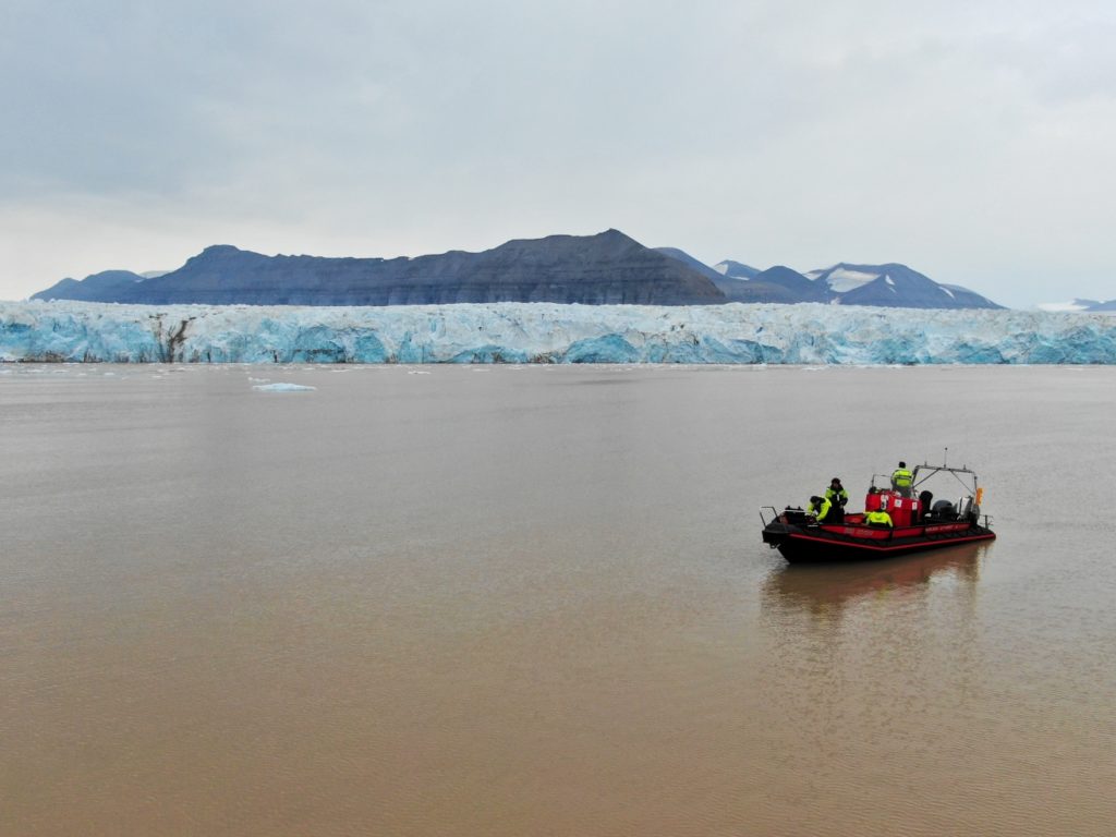
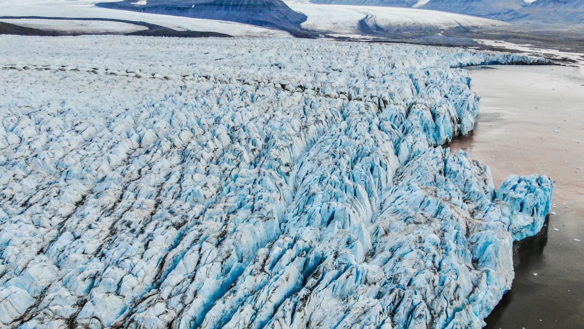
When we arrive at the glacier front, we need to make sure that we keep our distance from it. During the melt-season the glaciers move a lot and massive pieces of ice can fall from the glacier front into the water. This is called “calving” and could be a danger to the boat if we were too close. Because this summer has been very warm, we have observed a lot of calving.
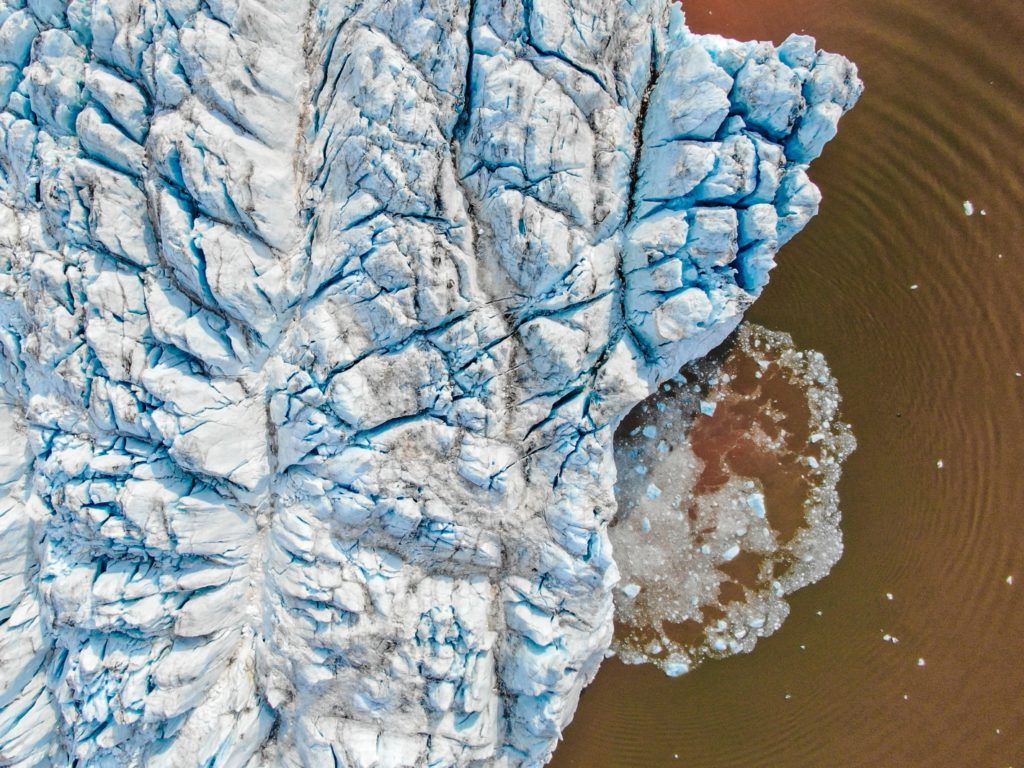
From a safe distance, we take-off with our drone from the boat and fly over the glacier. The drone flies on a pre-programmed route and continuously takes downward-facing pictures of the glacier surface. We can use these images to create a 3D model of the glacier surface, with a method called “structure from motion”.
We usually spend several hours at the glacier as we try to map its entire front. Flying the drone is often not easy, especially when it is cold, windy, or when the GPS signals are disturbed. Atmospheric icing can also be a risk. In addition, we have to lookout for wildlife – especially birds can be curious about our drone and sometimes become aggressive.
The data we gather from our fieldwork is used to study the effects of crevasses on the melting of glaciers. Crevasses – cracks in the ice – increase the surface roughness of the glacier and expose a larger area to the atmosphere. With rising air temperatures due to climate change, this means that glaciers with crevasses warm faster than non-crevassed glaciers, which leads to higher melting rates.
Related article: Drones Help Reveal the Secrets of Glacier Crevasses
