Preventing motion blur in drone mapping
Motion blur is an unwanted photo effect that occurs when a picture is taken with a long exposure and rapid movements. In drone mapping, motion blur occurs when the drone is flying at a high speed while taking pictures. If the flight speed is high in comparison with the shutter speed and the ground resolution, or ground sample distance (GSD), motion blur occurs. Because motion blur depends on the GSD, it also depends on the flight altitude and the type of camera.
In practice, motion blur can occur during missions at low altitudes, low-light conditions, or high flight velocities. Motion blur reduced the quality of the taken images and leads to low-quality mapping products such as digital elevation models (DEMs) or orthomosaics. For this reason, it is important to take motion blur into consideration during the planning and pre-flight phase. In the following, I will present a simple method that can mitigate the motion blur ris.
To prevent motion blur, a good rule of thumb is that the camera shutter speed should be so faster than the time it takes for a point on the ground to move one GSD-length. Ideally, this prevents that a ground point from getting captured more than once by the camera. The maximum allowed shutter speed can be calculated with:
Maximum shutter speed = Ground sample distance / Drone speed
Calculating the GSD requires specific information about the camera type. To make things easier, I have prepared a few tables for the most common drone types and calculated the maximum shutter speeds to prevent motion blur.
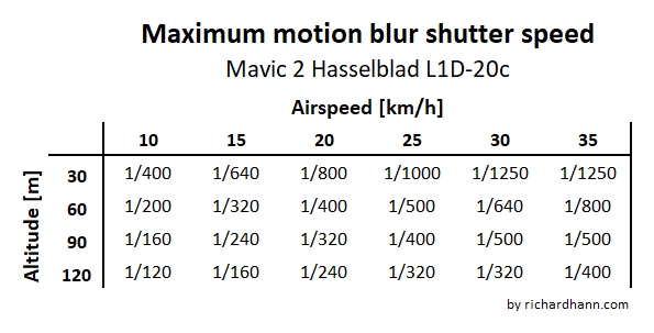
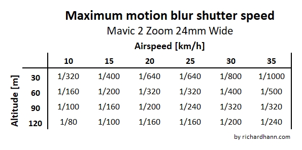
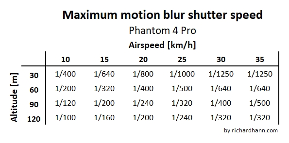
How am I using this in practice? Before starting a mapping mission, I am fly the drone to the desired altitude and take a few sample pictures to check which shutter speed the current conditions require (I usually use the “auto” camera settings). If the shutter speeds are higher than in the tables, I would fly the mission with a slower velocity. I could also increase the altitude, but since I have usually planned for a specific GSD, I typically want to avoid changing it.
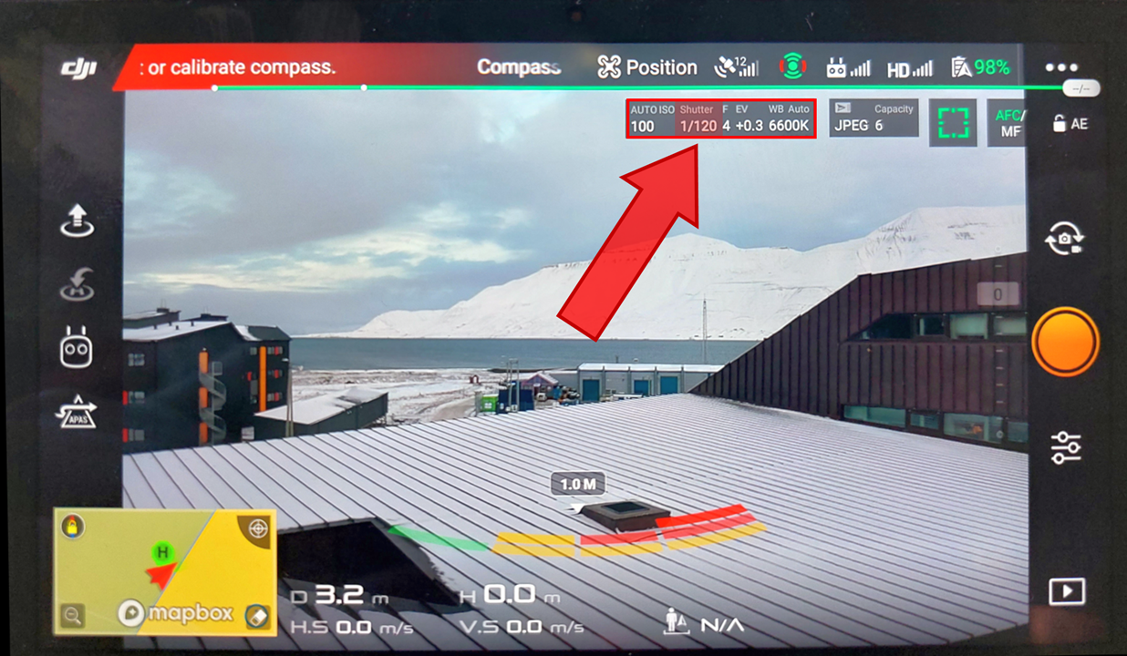
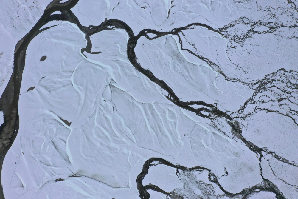
Example: During a mapping flight in Svalbard in early October, I encountered relatively low-light conditions and had to wanted a GSD of about 2cm/pixel for a high-resolution orthomosaic of a river delta. With a Mavic 2 Pro. My plan was to fly at 90m of altitude with a cruise speed for 30km/h. The test pictures indicated that the shutter speed would be between 1/320 and 1/400. Since the maximum motion blur shutter speed for according to my table is 1/500, I decided to decrease my cruise speed to 18km/h. The pictures came out crisp and clear.